Geolocate

Gaja topographic map

Click on the map to display elevation.

About this map

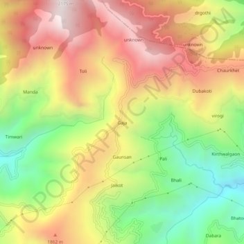
Name: Gaja topographic map, elevation, terrain.

Location: Gaja, Narendra Nagar, Tehri Garhwal District, Uttarakhand, India (30.24896 78.40226 30.28896 78.44226)

Average elevation: 1,599 m

Minimum elevation: 1,009 m

Maximum elevation: 2,177 m

Other topographic maps

Click on a map to view its topography, its elevation and its terrain.

Dhalwala park

India > Uttarakhand > Narendra Nagar

Average elevation: 390 m

Gear up for your next adventure:

🧢Hiking Sun Hat - Wide-brimmed protection for exposed mountain ridges
🔪Outdoor Multitool - Versatile tool for repairs and food prep in the wild
🥾Waterproof Hiking Boots - Boots keeping your feet dry in wet conditions
🏕️Camping Hammock - Integrated protection for sleeping between trees
🥾Mountain Hiking Boots - High-traction boots for rocky terrain

As an Amazon Associate, this site earns from qualifying purchases at no extra cost to you.