Geolocate

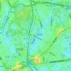
Uehara topographic map

Click on the map to display elevation.

About this map

Name: Uehara topographic map, elevation, terrain.

Location: Uehara, Shibuya, Tokyo, 151-0064, Japan (35.66306 139.67368 35.67011 139.68791)

Average elevation: 39 m

Minimum elevation: 21 m

Maximum elevation: 60 m

Other topographic maps

Click on a map to view its topography, its elevation and its terrain.
七号通り公園

Japan > Shibuya

Average elevation: 40 m

Harajuku

Japan > Shibuya

Average elevation: 37 m

Harajuku

Japan > Shibuya

Average elevation: 37 m

Gear up for your next adventure:

🔋Emergency Crank Radio - Weather alerts and power without needing batteries
☕Camping Coffee Maker - Brew fresh coffee anywhere on the topographic map
💡LED Headlamp - Hands-free illumination for night hiking and camping
🏕️Camping Hammock - Integrated protection for sleeping between trees
🛶Canoe Life Vest - Safety vest for water sports

As an Amazon Associate, this site earns from qualifying purchases at no extra cost to you.