Geolocate

Churumazu topographic map

Click on the map to display elevation.

About this map

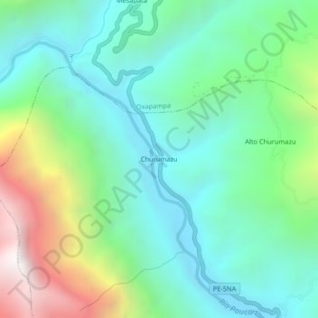
Name: Churumazu topographic map, elevation, terrain.

Location: Churumazu, Villa Rica, Oxapampa, Pasco, Perú (-10.79153 -75.37913 -10.75153 -75.33913)

Average elevation: 1,369 m

Minimum elevation: 874 m

Maximum elevation: 2,636 m

Gear up for your next adventure:

Camping Essentials - All-in-one gear for a comfortable camping trip
🧥Insulated Jacket - Keep warm in cold outdoor conditions
🧥Ultralight Puffy Jacket - Maximum warmth that packs down to the size of an orange
🧭GPS Outdoor Watch - Smart watch for navigation and fitness tracking in nature
🔥Camping Stove - Portable stoves to cook outdoors with ease

As an Amazon Associate, this site earns from qualifying purchases at no extra cost to you.