Geolocate

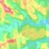
Linha São Sebastião topographic map

Click on the map to display elevation.

About this map

Name: Linha São Sebastião topographic map, elevation, terrain.

Location: Linha São Sebastião, Francisco Beltrão, Paraná, Região Sul, Brasil (-26.02411 -53.00606 -25.98411 -52.96606)

Average elevation: 525 m

Minimum elevation: 474 m

Maximum elevation: 618 m

Other topographic maps

Click on a map to view its topography, its elevation and its terrain.

Rio Marrecas

Brasil > Paraná > Francisco Beltrão

Average elevation: 581 m

Rio Bonito

Brasil > Paraná > Francisco Beltrão

Average elevation: 690 m

Gear up for your next adventure:

🥾Mountain Hiking Boots - High-traction boots for rocky terrain
🔨Vehicle Emergency Tool - Safety tool for remote road trips to trailheads
🔦UV Flashlight - Detect minerals or specific insects in the dark
🥤Collapsible Travel Cup - Saves space and weight in your mess kit
🧢Hiking Hat - Sun-protective and breathable hats for long treks

As an Amazon Associate, this site earns from qualifying purchases at no extra cost to you.