Geolocate

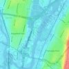
West View topographic map

Click on the map to display elevation.

About this map

Name: West View topographic map, elevation, terrain.

Location: West View, Ridgefield Park, Bergen County, New Jersey, 07603, United States (40.84510 -74.04764 40.88510 -74.00764)

Average elevation: 12 m

Minimum elevation: -4 m

Maximum elevation: 52 m

Other topographic maps

Click on a map to view its topography, its elevation and its terrain.
Gear up for your next adventure:

🛶Kayak Accessories - Essential gear for safe and fun kayaking adventures
🚲MTB Frame Bag - Carry tools and maps directly on your bicycle frame
🧰Survival Kit - Essential gear for emergencies in the wilderness
🎒Hiking Backpack - Lightweight and ergonomic backpacks for day hikes or multi-day treks
🥾Waterproof Hiking Boots - Essential footwear for rugged terrain and wet Canadian trails

As an Amazon Associate, this site earns from qualifying purchases at no extra cost to you.