Geolocate

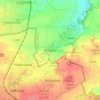
Roztoky topographic map

Click on the map to display elevation.

About this map

Name: Roztoky topographic map, elevation, terrain.

Location: Roztoky, okres Praha-západ, Central Bohemian Region, 252 63, Czechia (50.14125 14.34681 50.17276 14.40413)

Average elevation: 238 m

Minimum elevation: 166 m

Maximum elevation: 301 m

Other topographic maps

Click on a map to view its topography, its elevation and its terrain.

Studce

Czechia > Central Bohemian Region

Average elevation: 235 m

Trojhran

Czechia > Central Bohemian Region > Žehrov

Average elevation: 285 m

Mezivrata

Czechia > Central Bohemian Region > Neustupov

Average elevation: 630 m

Gear up for your next adventure:

🌡️Emergency Mylar Blankets - Compact thermal protection for unexpected nights outdoors
🧥Thermal Layer - Insulating layer for cold outdoor conditions
🥾Mountain Trail Shoes - High-traction shoes for mountain trails
🔥Emergency Fire Starter - Reliable ignition source for all weather conditions
👟Trail Running Shoes - Agile footwear for fast-paced topographic exploration

As an Amazon Associate, this site earns from qualifying purchases at no extra cost to you.