
Wijchen topographic map
Interactive map
Click on the map to display elevation.
About this map
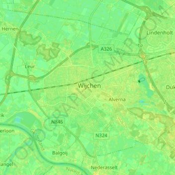
Name: Wijchen topographic map, elevation, terrain.
Location: Wijchen, Geldern, Niederlande (51.77785 5.67551 51.83971 5.80095)
Average elevation: 9 m
Minimum elevation: 1 m
Maximum elevation: 16 m
Other topographic maps
Click on a map to view its topography, its elevation and its terrain.
Batenburg
Niederlande > Geldern > Wijchen
Batenburg, Wijchen, Geldern, Niederlande
Average elevation: 8 m
Hernen
Niederlande > Geldern > Wijchen
Hernen, Dorpsstraat, Hernen, Wijchen, Geldern, Niederlande, 6616BE, Niederlande
Average elevation: 8 m