Geolocate

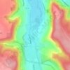
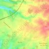
Autigny topographic map

Click on the map to display elevation.

About this map

Name: Autigny topographic map, elevation, terrain.

Location: Autigny, Dieppe, Seine-Maritime, Normandy, Metropolitan France, 76740, France (49.78154 0.83871 49.81051 0.86911)

Average elevation: 94 m

Minimum elevation: 53 m

Maximum elevation: 122 m

Other topographic maps

Click on a map to view its topography, its elevation and its terrain.
Saint-Adrien

France > Normandy > Seine-Maritime > Belbeuf

Average elevation: 56 m

Puys Beach

France > Normandy > Seine-Maritime > Dieppe > Puys

Average elevation: 30 m

Le Pollet

France > Normandy > Seine-Maritime > Torcy-le-Petit

Average elevation: 84 m

Edreville

France > Normandy > Seine-Maritime > Octeville-sur-Mer

Average elevation: 78 m

La Grand Route

France > Normandy > Seine-Maritime > Écalles-Alix

Average elevation: 147 m

Le Pière

France > Normandy > Seine-Maritime > Étaimpuis

Average elevation: 157 m

La Fresnaye

France > Normandy > Seine-Maritime > Buchy

Average elevation: 201 m

Gear up for your next adventure:

🔋Lithium AA Batteries - Long-lasting power that performs in extreme cold
🧢Sun Hat - Wide-brim hat for sun protection
🧭GPS Handheld Device - Reliable GPS navigation for outdoor adventures
🛶Canoe Life Vest - Safety vest for water sports
🔦LED Headlamp - Hands-free lighting for early morning starts or late finishes

As an Amazon Associate, this site earns from qualifying purchases at no extra cost to you.