Geolocate

Aralvaimozhi topographic map

Click on the map to display elevation.

About this map
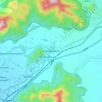
Name: Aralvaimozhi topographic map, elevation, terrain.

Location: Aralvaimozhi, Thovalai, Kanniyakumari, Tamil Nadu, 629301, India (8.21063 77.48185 8.29063 77.56185)

Average elevation: 192 m

Minimum elevation: 30 m

Maximum elevation: 955 m

Gear up for your next adventure:

🧢Outdoor Cap - Protective cap for sun and rain during hikes
🩹Compact First Aid Kit - Pre-packed essentials for common trail injuries
💧Hydration Bladder - Hands-free hydration solution for long treks
⛺Lightweight Backpacking Tent - Compact tent for efficient hiking trips
🥾Trail Hiking Boots - Supportive boots for rough trails

As an Amazon Associate, this site earns from qualifying purchases at no extra cost to you.