Geolocate

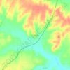
Mound City topographic map

Click on the map to display elevation.

About this map

Name: Mound City topographic map, elevation, terrain.

Location: Mound City, Linn County, Kansas, 66056, United States (38.10968 -94.89664 38.14963 -94.79678)

Average elevation: 288 m

Minimum elevation: 250 m

Maximum elevation: 336 m

Other topographic maps

Click on a map to view its topography, its elevation and its terrain.
Farlinville

United States > Kansas > Linn County

Average elevation: 267 m

Centerville

United States > Kansas > Linn County

Average elevation: 287 m

Gear up for your next adventure:

🧢Hiking Sun Hat - Wide-brimmed protection for exposed mountain ridges
🔥Emergency Fire Starter - Reliable ignition source for all weather conditions
🧣Merino Neck Gaiter - Protects against wind, sun, and cold at high altitudes
🥾Lightweight Hiking Boots - Boots for comfort and mobility on long hikes
🧰Survival Kit - Essential gear for emergencies in the wilderness

As an Amazon Associate, this site earns from qualifying purchases at no extra cost to you.