Geolocate

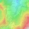
La Roche topographic map

Click on the map to display elevation.

About this map

Name: La Roche topographic map, elevation, terrain.

Location: La Roche, Saint-Pierre-d'Allevard, Crêts-en-Belledonne, Grenoble, Isère, Auvergne-Rhône-Alpes, France métropolitaine, 38830, France (45.36245 6.02917 45.40245 6.06917)

Average elevation: 763 m

Minimum elevation: 441 m

Maximum elevation: 1,313 m

Other topographic maps

Click on a map to view its topography, its elevation and its terrain.
Gear up for your next adventure:

🛶Canoe Life Vest - Safety vest for water sports
🧭GPS Handheld Device - Reliable GPS navigation for outdoor adventures
🔨Vehicle Emergency Tool - Safety tool for remote road trips to trailheads
🔋Solar Power Bank - Keep your GPS and devices charged during long outdoor trips
🚲Bike Repair Kit - Essential tools for on-trail mechanical issues

As an Amazon Associate, this site earns from qualifying purchases at no extra cost to you.