Geolocate

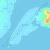
Baluno topographic map

Click on the map to display elevation.

About this map

Name: Baluno topographic map, elevation, terrain.

Location: Baluno, Zamboanga City, Zamboanga Peninsula, 7000, Philippines (6.95746 121.97277 6.99746 122.01277)

Average elevation: 254 m

Minimum elevation: 5 m

Maximum elevation: 571 m

Other topographic maps

Click on a map to view its topography, its elevation and its terrain.

Sacol Island

Philippines > Zamboanga City

Average elevation: 6 m

Vitali River

Philippines > Zamboanga City > Mangusu

Average elevation: 27 m

Sinunug Island

Philippines > Zamboanga City

Average elevation: 0 m

Plaza Pershing

Philippines > Zamboanga City

Average elevation: 4 m

Gear up for your next adventure:

🧣Merino Neck Gaiter - Protects against wind, sun, and cold at high altitudes
🧦Crew Hiking Socks - Comfortable socks for long-distance hikes
👖Convertible Hiking Pants - Zip-off legs to adapt to changing weather conditions
🎒Fully Waterproof Backpack - Total protection for photography gear and electronics
🛶Waterproof Dry Bags - Keep electronics and clothes dry during river crossings

As an Amazon Associate, this site earns from qualifying purchases at no extra cost to you.