Geolocate

Balansay topographic map

Click on the map to display elevation.

About this map
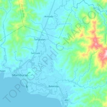
Name: Balansay topographic map, elevation, terrain.

Location: Balansay, Mamburao, Occidental Mindoro, Mimaropa, Philippines (13.17976 120.61816 13.32832 120.71241)

Average elevation: 100 m

Minimum elevation: 0 m

Maximum elevation: 776 m

Other topographic maps

Click on a map to view its topography, its elevation and its terrain.

Dungon

Philippines > Occidental Mindoro > Mamburao > Tayamaan

Average elevation: 11 m

Gear up for your next adventure:

🧢Outdoor Visor - Breathable visor for sunny hikes
🚲Handlebar Phone Mount - View topographic-map.com live while cycling
🎒Fully Waterproof Backpack - Total protection for photography gear and electronics
🧥Softshell Jacket - Windproof and breathable jacket for hiking
🩹Moleskin Blister Pads - Direct protection for painful foot pressure points

As an Amazon Associate, this site earns from qualifying purchases at no extra cost to you.