Geolocate

Meckesheim topographic map

Click on the map to display elevation.

About this map
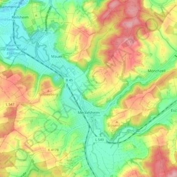
Name: Meckesheim topographic map, elevation, terrain.

Location: Meckesheim, GVV Elsenztal, Rhein-Neckar-Kreis, Baden-Württemberg, 74909, Germany (49.30493 8.77812 49.35265 8.86727)

Average elevation: 183 m

Minimum elevation: 123 m

Maximum elevation: 259 m

Other topographic maps

Click on a map to view its topography, its elevation and its terrain.

Gear up for your next adventure:

🧦Crew Hiking Socks - Comfortable socks for long-distance hikes
💡Solar Camping Lamp - Eco-friendly lighting for campsites
👟Leg Gaiters - Keep debris, mud, and snow out of your boots
🛏️Camping Sleeping Mat - Comfortable mats for sleeping outdoors
🕯️Camping Lantern - Illuminates your entire campsite with high-efficiency LEDs

As an Amazon Associate, this site earns from qualifying purchases at no extra cost to you.