

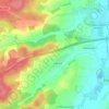
Gabelbach topographic map
Click on the map to display elevation.
Gabelbach
Der Ort liegt südwestlich des Hauptortes im mittleren Zusamtal zwischen Zusmarshausen und Dinkelscherben. Direkt an der Bahnstrecke Augsburg–Ulm gelegen, breitet er sich auf der flacheren Talwestseite unterhalb des bewaldeten Höhenrückens zwischen Zusam- und Mindeltal aus. Zudem ist die Bundesautobahn 8 München – Stuttgart nur drei Kilometer entfernt.
About this map

Name: Gabelbach topographic map, elevation, terrain.
Average elevation: 488 m
Minimum elevation: 440 m
Maximum elevation: 541 m
Other topographic maps
Click on a map to view its topography, its elevation and its terrain.
86441
Deutschland > Bayern > Landkreis Augsburg > Zusmarshausen > Wollbach > Vallried
Average elevation: 478 m