Geolocate

Feijó topographic map

Click on the map to display elevation.

About this map
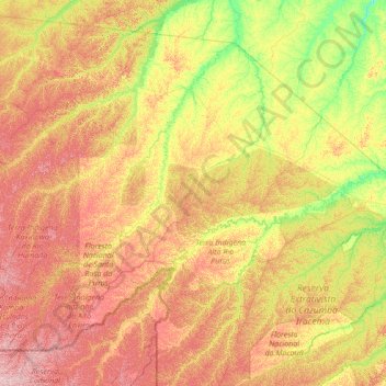
Name: Feijó topographic map, elevation, terrain.

Location: Feijó, Acre, North Region, Brazil (-10.00045 -72.18103 -7.79200 -69.44304)

Average elevation: 225 m

Minimum elevation: 130 m

Maximum elevation: 404 m

Other topographic maps

Click on a map to view its topography, its elevation and its terrain.

Maloca

Brazil > Acre > Porto Walter

Average elevation: 197 m

Bonfim

Brazil > Acre > Plácido de Castro

Average elevation: 187 m

Gear up for your next adventure:

⛺Camping Essentials - All-in-one gear for a comfortable camping trip
🧢Sun Hat - Wide-brim hat for sun protection
🧦Merino Wool Socks - Moisture-wicking comfort for long-distance hiking
🪑Insulated Seat Pad - Protect your seat from cold rocks and wet logs
👟Leg Gaiters - Keep debris, mud, and snow out of your boots

As an Amazon Associate, this site earns from qualifying purchases at no extra cost to you.