Geolocate

Navrangpura topographic map

Click on the map to display elevation.

About this map
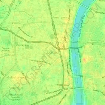
Name: Navrangpura topographic map, elevation, terrain.

Location: Navrangpura, SabarmatiTaluka, Ahmedabad, Gujarat, 380009, India (23.01600 72.54434 23.05600 72.58434)

Average elevation: 52 m

Minimum elevation: 35 m

Maximum elevation: 63 m

Other topographic maps

Click on a map to view its topography, its elevation and its terrain.

Chandkheda

India > Gujarat > SabarmatiTaluka

Average elevation: 60 m

Law Garden

India > Gujarat > SabarmatiTaluka > Ahmedabad

Average elevation: 52 m

Parimal Garden

India > Gujarat > SabarmatiTaluka

Average elevation: 52 m

Gear up for your next adventure:

🥾Hiking Leggings - Comfortable leggings for outdoor activities
🔪Outdoor Multitool - Versatile tool for repairs and food prep in the wild
🎒Hiking Backpack - Lightweight and ergonomic backpacks for day hikes or multi-day treks
🧥Thermal Fleece Jacket - Versatile insulation for changing mountain temperatures
🥾Trekking Boots - Durable boots for long-distance trekking

As an Amazon Associate, this site earns from qualifying purchases at no extra cost to you.