
Tumeltsham topographic map
Interactive map
Click on the map to display elevation.
About this map
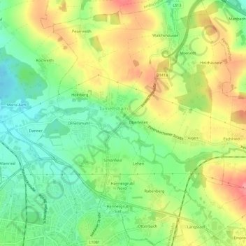
Name: Tumeltsham topographic map, elevation, terrain.
Location: Tumeltsham, Bezirk Ried im Innkreis, 4911, Austria (48.21113 13.47896 48.24757 13.53140)
Average elevation: 447 m
Minimum elevation: 407 m
Maximum elevation: 496 m