
Johnstown topographic map
Click on the map to display elevation.
About this map
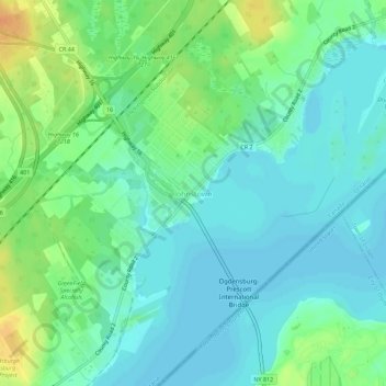
Name: Johnstown topographic map, elevation, terrain.
Average elevation: 83 m
Minimum elevation: 72 m
Maximum elevation: 106 m
Leeds and Grenville Counties trails, hiking, mountain biking, running and outdoor activities
Other topographic maps
Click on a map to view its topography, its elevation and its terrain.
Edwardsburgh
Canada > Ontario > Leeds and Grenville Counties > Edwardsburgh/Cardinal
Average elevation: 92 m