Geolocate

Ludwigshafen am Rhein topographic map

Click on the map to display elevation.

About this map

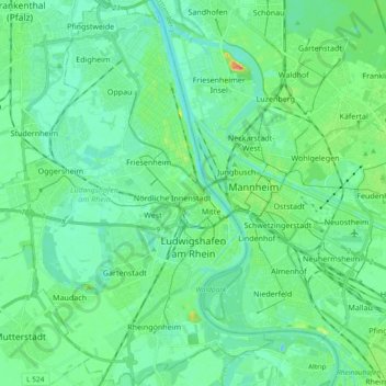
Name: Ludwigshafen am Rhein topographic map, elevation, terrain.

Location: Ludwigshafen am Rhein, Rhineland-Palatinate, Germany (49.42670 8.29822 49.54806 8.47694)

Average elevation: 96 m

Minimum elevation: 83 m

Maximum elevation: 140 m

Other topographic maps

Click on a map to view its topography, its elevation and its terrain.

Gear up for your next adventure:

🧣Merino Neck Gaiter - Protects against wind, sun, and cold at high altitudes
🥾Trekking Poles - Adjustable trekking poles to reduce knee stress and improve stability
🥾Trail Hiking Boots - Supportive boots for rough trails
🧶550 Survival Paracord - Versatile utility cord for emergency repairs and rigging
🔭Compact Binoculars - Lightweight optics for scouting trails and wildlife

As an Amazon Associate, this site earns from qualifying purchases at no extra cost to you.