Geolocate

Erieau topographic map

Click on the map to display elevation.

About this map

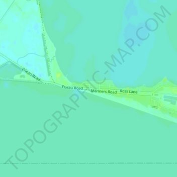
Name: Erieau topographic map, elevation, terrain.

Location: Erieau, Chatham-Kent, Southwestern Ontario, Ontario, Canada (42.25141 -81.93999 42.27141 -81.91999)

Average elevation: 172 m

Minimum elevation: 168 m

Maximum elevation: 178 m

Chatham-Kent trails, hiking, mountain biking, running and outdoor activities

Other topographic maps

Click on a map to view its topography, its elevation and its terrain.

Bothwell

Canada > Ontario > Chatham-Kent

Average elevation: 207 m

Thamesville

Canada > Ontario > Chatham-Kent

Average elevation: 188 m

Chatham

Canada > Ontario > Chatham-Kent

Average elevation: 182 m

Blythe Park

Canada > Ontario > Chatham-Kent > Chatham

Average elevation: 182 m

Harwich

Canada > Ontario > Chatham-Kent > Chatham

Average elevation: 189 m

Howard

Canada > Ontario > Chatham-Kent > Morpeth

Average elevation: 198 m

Chatham

Canada > Ontario > Chatham-Kent

Average elevation: 182 m

Gear up for your next adventure:

Family Camping Tent - Spacious tent suitable for family camping trips
🧥Waterproof Jacket - Lightweight rain jackets for hiking and outdoor activities
🧰Emergency Multi-Tool - Compact multi-tool for outdoor survival
Backpacking Tent - Lightweight tent for long-distance hiking trips
🎒Hiking Daypack - Lightweight and durable backpacks for day trips and excursions

As an Amazon Associate, this site earns from qualifying purchases at no extra cost to you.