Geolocate

Suisse topographic map

Click on the map to display elevation.

About this map
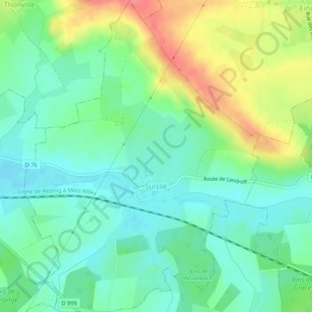
Name: Suisse topographic map, elevation, terrain.

Location: Suisse, Forbach-Boulay-Moselle, Moselle, Great East, Metropolitan France, 57340, France (48.95332 6.56142 48.98396 6.59666)

Average elevation: 256 m

Minimum elevation: 232 m

Maximum elevation: 300 m

Other topographic maps

Click on a map to view its topography, its elevation and its terrain.

Quater

France > Great East > Moselle > Réding

Average elevation: 283 m

Gear up for your next adventure:

🛶Kayak Accessories - Essential gear for safe and fun kayaking adventures
🩹Compact First Aid Kit - Pre-packed essentials for common trail injuries
🛌Insulated Sleeping Pad - Critical thermal barrier between you and the cold ground
🔪Outdoor Multitool - Versatile tool for repairs and food prep in the wild
🧥Ultralight Puffy Jacket - Maximum warmth that packs down to the size of an orange

As an Amazon Associate, this site earns from qualifying purchases at no extra cost to you.