
Cretes topographic map
Interactive map
Click on the map to display elevation.
About this map
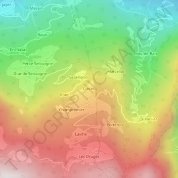
Name: Cretes topographic map, elevation, terrain.
Location: Cretes, Saint-Marcel, Vallée d'Aoste, Italie (45.71734 7.47410 45.71826 7.47603)
Average elevation: 1,205 m
Minimum elevation: 615 m
Maximum elevation: 1,815 m
Other topographic maps
Click on a map to view its topography, its elevation and its terrain.
Druges Alte
Italie > Vallée d'Aoste > Saint-Marcel
Druges Alte, Saint-Marcel, Vallée d'Aoste, Italie
Average elevation: 1,582 m