Geolocate

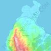
Kadudampit topographic map

Click on the map to display elevation.

About this map

Name: Kadudampit topographic map, elevation, terrain.

Location: Kadudampit, Pandeglang, Banten, 42271, Indonesia (-6.41715 105.97302 -6.37715 106.01302)

Average elevation: 138 m

Minimum elevation: 74 m

Maximum elevation: 347 m

Other topographic maps

Click on a map to view its topography, its elevation and its terrain.
Tanjungjaya

Indonesia > Banten > Pandeglang

Average elevation: 37 m

Tanjungjaya

Indonesia > Banten > Pandeglang

Average elevation: 37 m

Gear up for your next adventure:

⛺Backpacking Tent - Lightweight tent for long-distance hiking trips
⛺Lightweight Backpacking Tent - Compact tent for efficient hiking trips
🧴Bear Spray Holster - Quick-access carry for essential Canadian wilderness safety
🦟Insect Repellent - Keep mosquitoes and black flies away in wooded areas
🔨Vehicle Emergency Tool - Safety tool for remote road trips to trailheads

As an Amazon Associate, this site earns from qualifying purchases at no extra cost to you.