Geolocate

Dinsmore topographic map

Click on the map to display elevation.

About this map

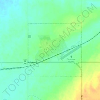
Name: Dinsmore topographic map, elevation, terrain.

Location: Dinsmore, Division No. 12, Saskatchewan, S0L 0T0, Canada (51.32509 -107.45663 51.33962 -107.43348)

Average elevation: 614 m

Minimum elevation: 603 m

Maximum elevation: 632 m

Division No. 12 trails, hiking, mountain biking, running and outdoor activities

Other topographic maps

Click on a map to view its topography, its elevation and its terrain.

Gear up for your next adventure:

🔭Outdoor Binoculars - Lightweight binoculars for birdwatching and hiking
🔭Compact Monocular - One-handed bird watching and trail spotting
🧴Sunscreen SPF - Broad-spectrum sunscreen for outdoor activities
🥾Approach Boots - Comfortable boots for hiking and climbing approaches
🦌Outdoor Trail Camera - Monitor wildlife activity near your favorite spots

As an Amazon Associate, this site earns from qualifying purchases at no extra cost to you.