
Thank you for supporting this site ❤️
Make a donation
Make a donation
Gear up for your next adventure:
As an Amazon Associate, this site earns from qualifying purchases at no extra cost to you.
Boquía topographic map
Click on the map to display elevation.
Thank you for supporting this site ❤️
Make a donation
Make a donation
Gear up for your next adventure:
As an Amazon Associate, this site earns from qualifying purchases at no extra cost to you.
About this map
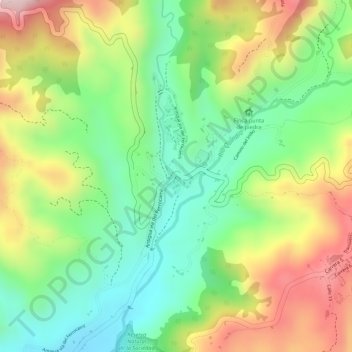
Name: Boquía topographic map, elevation, terrain.
Location: Boquía, Salento, Fría, Quindío, 631027, Colombia (4.63262 -75.59632 4.65262 -75.57632)
Average elevation: 1,844 m
Minimum elevation: 1,700 m
Maximum elevation: 2,025 m
Thank you for supporting this site ❤️
Make a donation
Make a donation
Gear up for your next adventure:
As an Amazon Associate, this site earns from qualifying purchases at no extra cost to you.