Geolocate

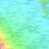
Borseth topographic map

Click on the map to display elevation.

About this map

Name: Borseth topographic map, elevation, terrain.

Location: Borseth, Alangalang, 1st District, Leyte, Eastern Visayas, 6518, Philippines (11.23835 124.79321 11.27835 124.83321)

Average elevation: 27 m

Minimum elevation: 13 m

Maximum elevation: 45 m

Other topographic maps

Click on a map to view its topography, its elevation and its terrain.
Mainit River

Philippines > Leyte > Alangalang

Average elevation: 49 m

Gear up for your next adventure:

🥾Mountain Hiking Shoes - Shoes with superior grip for mountainous terrain
🎒Hiking Daypack - Lightweight and durable backpacks for day trips and excursions
⛺Camping Groundsheet - Protect your tent from moisture and dirt
👖Convertible Hiking Pants - Zip-off legs to adapt to changing weather conditions
🛶Canoe Life Vest - Safety vest for water sports

As an Amazon Associate, this site earns from qualifying purchases at no extra cost to you.