Geolocate

Balele topographic map

Click on the map to display elevation.

About this map
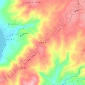
Name: Balele topographic map, elevation, terrain.

Location: Balele, Tanauan, Batangas, Calabarzon, 4232, Philippines (14.04264 121.07188 14.08264 121.11188)

Average elevation: 99 m

Minimum elevation: 3 m

Maximum elevation: 165 m

Other topographic maps

Click on a map to view its topography, its elevation and its terrain.

Talaga

Philippines > Batangas > Tanauan > Talaga

Average elevation: 135 m

Maria Paz

Philippines > Batangas > Tanauan

Average elevation: 64 m

Barangay 3

Philippines > Batangas > Tanauan > Hidalgo

Average elevation: 158 m

Barangay 5

Philippines > Batangas > Tanauan > Hidalgo

Average elevation: 154 m

Suplang

Philippines > Batangas > Tanauan

Average elevation: 247 m

Ambulong

Philippines > Batangas > Tanauan > Maugat

Average elevation: 28 m

Barangay 4

Philippines > Batangas > Tanauan

Average elevation: 142 m

Darasa

Philippines > Batangas > Tanauan > Hidalgo

Average elevation: 173 m

Laurel

Philippines > Batangas > Tanauan

Average elevation: 153 m

Banjo West

Philippines > Batangas > Tanauan > Banjo Laurel

Average elevation: 155 m

Darasa

Philippines > Batangas > Tanauan > Hidalgo

Average elevation: 173 m

Ulango

Philippines > Batangas > Tanauan

Average elevation: 145 m

Bañadero

Philippines > Batangas > Tanauan > Bañadero

Average elevation: 58 m

Barangay 5

Philippines > Batangas > Tanauan > Hidalgo

Average elevation: 154 m

Gear up for your next adventure:

🔦UV Flashlight - Detect minerals or specific insects in the dark
👟Sport Hiking Sandals - Breathable footwear for water crossings and camp rest
💧Hydration Bladder - Hands-free hydration solution for long treks
👖Convertible Hiking Pants - Zip-off legs to adapt to changing weather conditions
🧢Sun Protection Cap - Breathable cap to protect from sun exposure

As an Amazon Associate, this site earns from qualifying purchases at no extra cost to you.