Geolocate

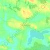
Cooloo topographic map

Click on the map to display elevation.

About this map

Name: Cooloo topographic map, elevation, terrain.

Location: Cooloo, Cooloo ED, Ballinasloe Municipal District, County Galway, Connacht, Ireland (53.47529 -8.67685 53.49966 -8.63250)

Average elevation: 75 m

Minimum elevation: 65 m

Maximum elevation: 89 m

Other topographic maps

Click on a map to view its topography, its elevation and its terrain.
Gear up for your next adventure:

🧴First Aid Kit - Essential first aid supplies for outdoor emergencies
💧Hydration Pack - Hands-free hydration system for long hikes
🧭GPS Outdoor Watch - Smart watch for navigation and fitness tracking in nature
🧭GPS Tracker - Track your location in remote areas safely
🛶Canoe Life Vest - Safety vest for water sports

As an Amazon Associate, this site earns from qualifying purchases at no extra cost to you.