Geolocate

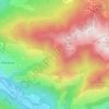
Escalette topographic map

Click on the map to display elevation.

About this map

Name: Escalette topographic map, elevation, terrain.

Location: Escalette, Boutx, Saint-Gaudens, Haute-Garonne, Occitanie, France métropolitaine, 31440, France (42.93437 0.72822 42.93447 0.72832)

Average elevation: 1,236 m

Minimum elevation: 759 m

Maximum elevation: 1,820 m

Other topographic maps

Click on a map to view its topography, its elevation and its terrain.
Argut-Dessus

France > Occitanie > Haute-Garonne > Boutx

Average elevation: 1,141 m

Couledoux

France > Occitanie > Haute-Garonne > Boutx

Average elevation: 1,119 m

Gear up for your next adventure:

🚲Handlebar Phone Mount - View topographic-map.com live while cycling
🧊Portable Cooler - Keep food and drinks cold during outdoor adventures
🔦LED Flashlight - Powerful and long-lasting flashlight for camping and emergencies
🔭Outdoor Binoculars - Lightweight binoculars for birdwatching and hiking
🧳Compression Sacks - Maximize space in your backpack by shrinking gear

As an Amazon Associate, this site earns from qualifying purchases at no extra cost to you.