
Gstaad topographic map
Click on the map to display elevation.
About this map
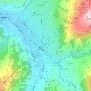
Name: Gstaad topographic map, elevation, terrain.
Average elevation: 1,245 m
Minimum elevation: 1,010 m
Maximum elevation: 1,922 m
Other topographic maps
Click on a map to view its topography, its elevation and its terrain.
Boltigen
Switzerland > Bern > Obersimmental-Saanen administrative district
The municipality includes the cooperative farms (Bäuerten) of Boltigen, Adlemsried, Eschi, Oberbäuert (which includes Littisbach and Unterbächen), Reidenbach, Schwarzenmatt, Simmenegg and Weissenbach. The area includes the valley floor around the Simme River, both sides of the valley and the surrounding…
Average elevation: 1,459 m