Geolocate

Nova topographic map

Click on the map to display elevation.

About this map
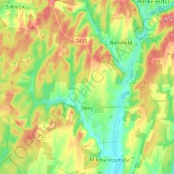
Name: Nova topographic map, elevation, terrain.

Location: Nova, Lenti járás, Zala, Transdanubia, 8948, Hungary (46.65342 16.61841 46.73671 16.72652)

Average elevation: 208 m

Minimum elevation: 165 m

Maximum elevation: 263 m

Gear up for your next adventure:

🚲Heavy Duty Bike Lock - Secure your bike at the trailhead or during stops
👟Trail Running Shoes - Agile footwear for fast-paced topographic exploration
🛌Down Sleeping Bag - Superior warmth-to-weight ratio for cold nights
💧Hydration Bladder - Hands-free hydration solution for long treks
🧢Sun Protection Cap - Breathable cap to protect from sun exposure

As an Amazon Associate, this site earns from qualifying purchases at no extra cost to you.