Geolocate

Lac Riopel topographic map

Click on the map to display elevation.

About this map
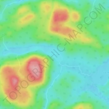
Name: Lac Riopel topographic map, elevation, terrain.

Location: Lac Riopel, Senneterre (ville), La Vallée-de-l'Or, Abitibi-Témiscamingue, Québec, Canada (48.13608 -76.29433 48.14027 -76.27209)

Average elevation: 499 m

Minimum elevation: 451 m

Maximum elevation: 589 m

Other topographic maps

Click on a map to view its topography, its elevation and its terrain.

Gear up for your next adventure:

🎒Hiking Backpack - Lightweight and ergonomic backpacks for day hikes or multi-day treks
🧢Outdoor Cap - Protective cap for sun and rain during hikes
🥾Lightweight Hiking Shoes - Comfortable shoes for day hikes
🦶Hiking Shoe Insoles - Added support for high arches and long days on feet
🧢Hiking Hat - Sun-protective and breathable hats for long treks

As an Amazon Associate, this site earns from qualifying purchases at no extra cost to you.