Geolocate

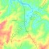
Wadley topographic map

Click on the map to display elevation.

About this map

Name: Wadley topographic map, elevation, terrain.

Location: Wadley, Randolph County, Alabama, United States (33.11254 -85.58702 33.13447 -85.55076)

Average elevation: 211 m

Minimum elevation: 183 m

Maximum elevation: 248 m

Other topographic maps

Click on a map to view its topography, its elevation and its terrain.
Newell

United States > Alabama > Randolph County

Average elevation: 286 m

Wedowee

United States > Alabama > Randolph County

Average elevation: 278 m

Flat Rock

United States > Alabama > Randolph County

Average elevation: 253 m

Gear up for your next adventure:

📷Outdoor Action Camera - Capture high-elevation views and rugged adventures
🔦LED Flashlight - Powerful and long-lasting flashlight for camping and emergencies
🧴First Aid Kit - Essential first aid supplies for outdoor emergencies
⛺Backpacking Tent - Lightweight tent for long-distance hiking trips
🐕Hiking Dog Pack - Let your canine companion carry their own water and food

As an Amazon Associate, this site earns from qualifying purchases at no extra cost to you.