
Narusawa topographic map
Click on the map to display elevation.
Narusawa
The city has a climate characterized by characterized by hot and humid summers, and relatively mild winters (Köppen climate classification Cfb). The average annual temperature in Kōshū is 9.6 °C. (Note that the preceding climate information is for a distant location in the same prefecture as Narusawa village that has a very different climate and elevation from Narusawa.) The average annual rainfall is 1751 mm with September as the wettest month.
About this map
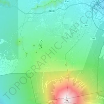
Name: Narusawa topographic map, elevation, terrain.
Average elevation: 1,411 m
Minimum elevation: 795 m
Maximum elevation: 3,757 m