Geolocate

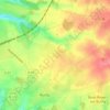
Yvetot topographic map

Click on the map to display elevation.

About this map

Name: Yvetot topographic map, elevation, terrain.

Location: Yvetot, Rouen, Seine-Maritime, Normandy, Metropolitan France, 76190, France (49.60176 0.73657 49.63498 0.80041)

Average elevation: 138 m

Minimum elevation: 75 m

Maximum elevation: 160 m

Other topographic maps

Click on a map to view its topography, its elevation and its terrain.
Saint-Adrien

France > Normandy > Seine-Maritime > Belbeuf

Average elevation: 56 m

Puys Beach

France > Normandy > Seine-Maritime > Dieppe > Puys

Average elevation: 30 m

Le Pollet

France > Normandy > Seine-Maritime > Torcy-le-Petit

Average elevation: 84 m

Edreville

France > Normandy > Seine-Maritime > Octeville-sur-Mer

Average elevation: 78 m

La Grand Route

France > Normandy > Seine-Maritime > Écalles-Alix

Average elevation: 147 m

Le Pière

France > Normandy > Seine-Maritime > Étaimpuis

Average elevation: 157 m

La Fresnaye

France > Normandy > Seine-Maritime > Buchy

Average elevation: 201 m

Gear up for your next adventure:

🦯Trekking Poles - Reduced impact on joints for steep topographic climbs
🥾Mountaineering Boots - Supportive boots for climbing and high-altitude hiking
💡Solar Camping Lamp - Eco-friendly lighting for campsites
⛺Camping Tent - Weather-resistant tents suitable for 2 to 6 people
🧣Merino Neck Gaiter - Protects against wind, sun, and cold at high altitudes

As an Amazon Associate, this site earns from qualifying purchases at no extra cost to you.