
Thank you for supporting this site ❤️
Make a donation
Make a donation
Gear up for your next adventure:
As an Amazon Associate, this site earns from qualifying purchases at no extra cost to you.
Tadepalle topographic map
Click on the map to display elevation.
Thank you for supporting this site ❤️
Make a donation
Make a donation
Gear up for your next adventure:
As an Amazon Associate, this site earns from qualifying purchases at no extra cost to you.
About this map
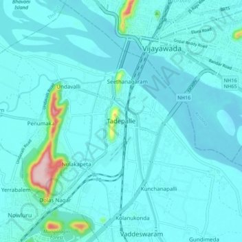
Name: Tadepalle topographic map, elevation, terrain.
Location: Tadepalle, Guntur District, Andhra Pradesh, 522501, India (16.44447 80.56438 16.52447 80.64438)
Average elevation: 29 m
Minimum elevation: 7 m
Maximum elevation: 245 m
Thank you for supporting this site ❤️
Make a donation
Make a donation
Gear up for your next adventure:
As an Amazon Associate, this site earns from qualifying purchases at no extra cost to you.