Geolocate

Giripurno topographic map

Click on the map to display elevation.

About this map
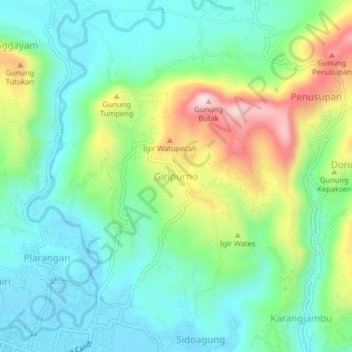
Name: Giripurno topographic map, elevation, terrain.

Location: Giripurno, Kebumen, Central Java, 54364, Indonesia (-7.63050 109.57319 -7.59050 109.61319)

Average elevation: 123 m

Minimum elevation: 12 m

Maximum elevation: 376 m

Other topographic maps

Click on a map to view its topography, its elevation and its terrain.

Pantai Ayah

Indonesia > Central Java > Kebumen > Ayah

Average elevation: 67 m

Gear up for your next adventure:

🥾Trail Hiking Boots - Supportive boots for rough trails
🦟Insect Repellent - Keep mosquitoes and black flies away in wooded areas
🔭Compact Binoculars - Lightweight optics for scouting trails and wildlife
⛺Camping Tent - Weather-resistant tents suitable for 2 to 6 people
🛶Canoe Life Vest - Safety vest for water sports

As an Amazon Associate, this site earns from qualifying purchases at no extra cost to you.