Geolocate

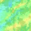
Ashtabula topographic map

Click on the map to display elevation.

About this map

Name: Ashtabula topographic map, elevation, terrain.

Location: Ashtabula, Ashtabula Township, Ashtabula County, Ohio, 44004, United States (41.84358 -80.83720 41.91178 -80.76721)

Average elevation: 202 m

Minimum elevation: 171 m

Maximum elevation: 263 m

Other topographic maps

Click on a map to view its topography, its elevation and its terrain.
Pierpont

United States > Ohio > Ashtabula County

Average elevation: 305 m

Chapel

United States > Ohio > Ashtabula County

Average elevation: 258 m

Phelps Creek

United States > Ohio > Ashtabula County

Average elevation: 326 m

Pierpont

United States > Ohio > Ashtabula County

Average elevation: 305 m

Gear up for your next adventure:

💧Collapsible Water Bottle - Space-saving water bottle for outdoor activities
🕶️Polarized Sunglasses - Protect your eyes with durable polarized lenses
🥾Mountain Hiking Boots - High-traction boots for rocky terrain
🚲Bike Repair Kit - Essential tools for on-trail mechanical issues
🛏️Sleeping Bag - Warm and compact sleeping bags for outdoor camping

As an Amazon Associate, this site earns from qualifying purchases at no extra cost to you.