
Thank you for supporting this site ❤️
Make a donation
Make a donation
Gear up for your next adventure:
As an Amazon Associate, this site earns from qualifying purchases at no extra cost to you.
Capraga topographic map
Click on the map to display elevation.
Thank you for supporting this site ❤️
Make a donation
Make a donation
Gear up for your next adventure:
As an Amazon Associate, this site earns from qualifying purchases at no extra cost to you.
About this map
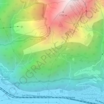
Name: Capraga topographic map, elevation, terrain.
Location: Capraga, Vogogna, Verbano-Cusio-Ossola, Piemont, 28805, Italien (46.00540 8.30354 46.02540 8.32354)
Average elevation: 780 m
Minimum elevation: 210 m
Maximum elevation: 1,869 m
Thank you for supporting this site ❤️
Make a donation
Make a donation
Gear up for your next adventure:
As an Amazon Associate, this site earns from qualifying purchases at no extra cost to you.