Geolocate

Grant City topographic map

Click on the map to display elevation.

About this map

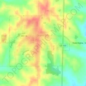
Name: Grant City topographic map, elevation, terrain.

Location: Grant City, Worth County, Missouri, 64456, United States (40.47495 -94.42498 40.49523 -94.40020)

Average elevation: 323 m

Minimum elevation: 292 m

Maximum elevation: 351 m

Gear up for your next adventure:

🛁Quick-Dry Microfiber Towel - Space-saving towel that dries rapidly on the move
🎒Backpack Rain Cover - External shield to keep your entire pack dry
🧳Compression Sacks - Maximize space in your backpack by shrinking gear
🚲Bike Repair Kit - Essential tools for on-trail mechanical issues
🍽️Titanium Camping Spork - Ultralight and indestructible eating utensil

As an Amazon Associate, this site earns from qualifying purchases at no extra cost to you.