Geolocate

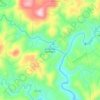
Cerro Negro topographic map

Click on the map to display elevation.

About this map
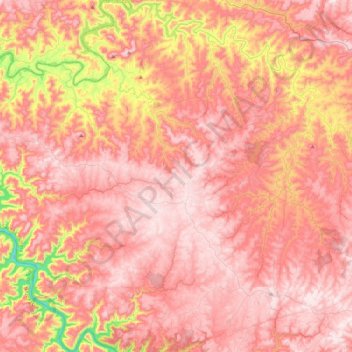
Name: Cerro Negro topographic map, elevation, terrain.

Location: Cerro Negro, Santa Catarina, South Region, 88585-000, Brazil (-27.96458 -51.05818 -27.56916 -50.84000)

Average elevation: 866 m

Minimum elevation: 507 m

Maximum elevation: 1,039 m

Other topographic maps

Click on a map to view its topography, its elevation and its terrain.
Três Picos

Brazil > Santa Catarina

Average elevation: 795 m

Residência Fuck

Brazil > Santa Catarina > Monte Castelo

Average elevation: 845 m

Córrego do Fuck

Brazil > Santa Catarina > Canoinhas

Average elevation: 786 m

Alto Pitanga

Brazil > Santa Catarina > Nova Trento

Average elevation: 427 m

Serra da Bateia

Brazil > Santa Catarina > Guabiruba

Average elevation: 339 m

Palhocinha

Brazil > Santa Catarina > Trombudo Central

Average elevation: 391 m

Pericó

Brazil > Santa Catarina > São Joaquim

Average elevation: 1,239 m

Gear up for your next adventure:

🏕️Camping Hammock - Integrated protection for sleeping between trees
🧥Softshell Jacket - Windproof and breathable jacket for hiking
🛌Insulated Sleeping Pad - Critical thermal barrier between you and the cold ground
🔋Emergency Crank Radio - Weather alerts and power without needing batteries
🧥Waterproof Pants - Keep dry during rainy hiking conditions

As an Amazon Associate, this site earns from qualifying purchases at no extra cost to you.