
Thank you for supporting this site ❤️
Make a donation
Make a donation
Gear up for your next adventure:
As an Amazon Associate, this site earns from qualifying purchases at no extra cost to you.
Peñoles topographic map
Click on the map to display elevation.
Thank you for supporting this site ❤️
Make a donation
Make a donation
Gear up for your next adventure:
As an Amazon Associate, this site earns from qualifying purchases at no extra cost to you.
About this map
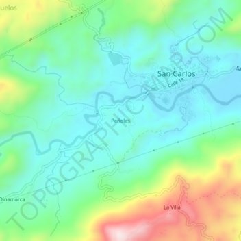
Name: Peñoles topographic map, elevation, terrain.
Location: Peñoles, San Carlos, Oriente, Antioquia, Colombia (6.16086 -75.02139 6.20086 -74.98139)
Average elevation: 1,097 m
Minimum elevation: 956 m
Maximum elevation: 1,461 m
Thank you for supporting this site ❤️
Make a donation
Make a donation
Gear up for your next adventure:
As an Amazon Associate, this site earns from qualifying purchases at no extra cost to you.