Geolocate

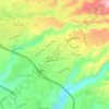
Kaʻala topographic map

Click on the map to display elevation.

About this map

Name: Kaʻala topographic map, elevation, terrain.

Location: Kaʻala, Waipahu, Honolulu County, Hawaii, 96786, United States (21.50770 -158.14235 21.50780 -158.14225)

Average elevation: 842 m

Minimum elevation: 430 m

Maximum elevation: 1,228 m

Other topographic maps

Click on a map to view its topography, its elevation and its terrain.

Waipahu

United States > Hawaii > Honolulu County > Waipahu

Average elevation: 32 m

Waipahu

United States > Hawaii > Honolulu County > Waipahu

Average elevation: 32 m

Mililani Mauka

United States > Hawaii > Honolulu County > Waipahu

Average elevation: 254 m

Gear up for your next adventure:

🛏️Sleeping Bag - Warm and compact sleeping bags for outdoor camping
🔨Vehicle Emergency Tool - Safety tool for remote road trips to trailheads
🥾Trekking Boots - Durable boots for long-distance trekking
🥾Trekking Poles - Adjustable trekking poles to reduce knee stress and improve stability
💡LED Camping Lantern - Illuminate your campsite with long-lasting lanterns

As an Amazon Associate, this site earns from qualifying purchases at no extra cost to you.