Geolocate

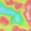
Cascade Charlemagne topographic map

Click on the map to display elevation.

About this map

Name: Cascade Charlemagne topographic map, elevation, terrain.

Location: Cascade Charlemagne, Route de Retournemer, Retournemer, Xonrupt-Longemer, Saint-Dié-des-Vosges, Vosges, Grand Est, France métropolitaine, 88400, France (48.05288 6.99003 48.05298 6.99013)

Average elevation: 1,017 m

Minimum elevation: 748 m

Maximum elevation: 1,302 m

Other topographic maps

Click on a map to view its topography, its elevation and its terrain.
Gear up for your next adventure:

🥽Outdoor Goggles - Protective eyewear for outdoor activities
🧥Waterproof Pants - Keep dry during rainy hiking conditions
🧥Waterproof Hiking Jacket - Protect yourself from rain and wind while hiking
🥫Freeze-Dried Meals - Lightweight, high-calorie nutrition for multi-day treks
🥾Light Hiking Boots - Lightweight and comfortable boots for day hikes

As an Amazon Associate, this site earns from qualifying purchases at no extra cost to you.