Geolocate

Cariliao topographic map

Click on the map to display elevation.

About this map

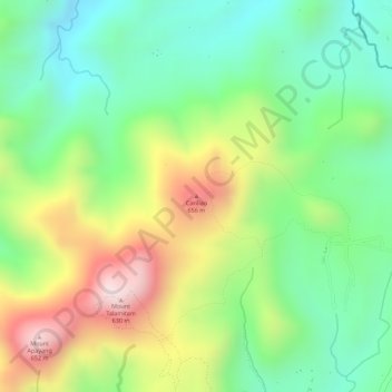
Name: Cariliao topographic map, elevation, terrain.

Location: Cariliao, Nasugbu, Batangas, Calabarzon, 4231, Philippines (14.11489 120.76523 14.11499 120.76533)

Average elevation: 354 m

Minimum elevation: 159 m

Maximum elevation: 636 m

Other topographic maps

Click on a map to view its topography, its elevation and its terrain.

Palico River

Philippines > Batangas > Nasugbu > Reparo

Average elevation: 44 m

Batulao

Philippines > Batangas > Nasugbu

Average elevation: 531 m

Pico de Loro Beach

Philippines > Batangas > Nasugbu

Average elevation: 43 m

Fortune Island

Philippines > Batangas > Nasugbu

Average elevation: 1 m

Talamitam

Philippines > Batangas > Nasugbu > Kayrilaw

Average elevation: 328 m

Fortune Island

Philippines > Batangas > Nasugbu

Average elevation: 1 m

Gear up for your next adventure:

🥾Approach Boots - Comfortable boots for hiking and climbing approaches
🔦LED Flashlight - Powerful and long-lasting flashlight for camping and emergencies
🛌Down Sleeping Bag - Superior warmth-to-weight ratio for cold nights
🧥Softshell Hiking Jacket - The perfect balance of wind protection and breathability
💧Collapsible Water Bottle - Space-saving water bottle for outdoor activities

As an Amazon Associate, this site earns from qualifying purchases at no extra cost to you.