Geolocate

Olvera topographic map

Click on the map to display elevation.

About this map
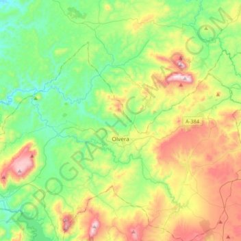
Name: Olvera topographic map, elevation, terrain.

Location: Olvera, Sierra de Cádiz, Cádiz, Andalusia, 11690, Spain (36.86964 -5.41680 37.03736 -5.09569)

Average elevation: 519 m

Minimum elevation: 213 m

Maximum elevation: 1,117 m

Other topographic maps

Click on a map to view its topography, its elevation and its terrain.
Las Catorce

Spain > Andalusia > Sierra de Cádiz > El Bosque

Average elevation: 364 m

Gear up for your next adventure:

🥾Hiking Shoes - Durable and comfortable shoes for trail hiking
🥾Approach Boots - Comfortable boots for hiking and climbing approaches
🥾Waterproof Hiking Shoes - Durable shoes for wet and rugged trails
⛺Backpacking Tent - Lightweight tent for long-distance hiking trips
🥾Trail Hiking Shoes - Durable shoes designed for rugged trails

As an Amazon Associate, this site earns from qualifying purchases at no extra cost to you.