Geolocate

San Rafael topographic map

Click on the map to display elevation.

About this map

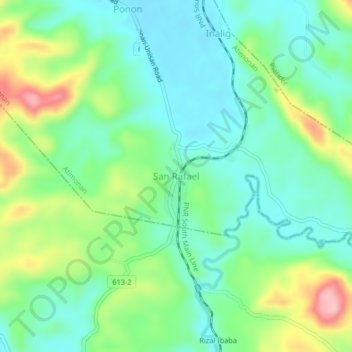
Name: San Rafael topographic map, elevation, terrain.

Location: San Rafael, Atimonan, Quezon, Calabarzon, Philippines (13.89778 121.97645 13.93778 122.01645)

Average elevation: 59 m

Minimum elevation: 7 m

Maximum elevation: 177 m

Gear up for your next adventure:

🧢Outdoor Cap - Protective cap for sun and rain during hikes
🪑Ultralight Camping Stool - Compact seating for rest stops during long hikes
🥾Lightweight Hiking Boots - Boots for comfort and mobility on long hikes
🥾Mountain Hiking Boots - High-traction boots for rocky terrain
🔦LED Headtorch - Bright and durable light for night activities

As an Amazon Associate, this site earns from qualifying purchases at no extra cost to you.