Geolocate

Bajaura topographic map

Click on the map to display elevation.

About this map

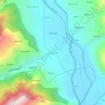
Name: Bajaura topographic map, elevation, terrain.

Location: Bajaura, Bhuntar, Kullu, Himachal Pradesh, 175125, India (31.82692 77.14108 31.86692 77.18108)

Average elevation: 1,255 m

Minimum elevation: 1,044 m

Maximum elevation: 1,979 m

Gear up for your next adventure:

🥾Trail Running Shoes - Lightweight and durable shoes for trail running
🧥Waterproof Pants - Keep dry during rainy hiking conditions
🔦LED Headlamp - Hands-free lighting for early morning starts or late finishes
🧼Travel Hand Sanitizer - Keep hands clean when water is scarce
🧰Multitool Knife - Compact and versatile tool for outdoor use

As an Amazon Associate, this site earns from qualifying purchases at no extra cost to you.