
Sindel topographic map
Interactive map
Click on the map to display elevation.
About this map
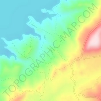
Name: Sindel topographic map, elevation, terrain.
Location: Sindel, Delibaşlı, Salihli, Manisa, Ägäisregion, Türkei (38.61782 28.35599 38.63782 28.37599)
Average elevation: 339 m
Minimum elevation: 221 m
Maximum elevation: 549 m